Friday, June 14, 2019

Two Capital Cities. One Day.

Part two of this journey is drawing to a close. El Burro is in hibernation in Montevideo for the next 3½ months, a guest of Willi's Moto's, the go to place for South American adventure riders. Across the River Plate (Rio de Plata) lies the city of Buenos Aires, Argentina where this post is being typed. Ferries connect the two cities, a high speed (and expensive) catamaran connects the cities directly in 2½ hours. A more economical option is to catch the ferry from Colonia, a narrower water crossing  that entails a 2½ coach ride from Montevideo for a 4 hour journey in all. I had time to spare so took the more frugal option on the pocket.

I visited Colonia de Sacramento earlier in the week. Another UNESCO location, nominated for the well preserved Portuguese area down by the port. My ride to Colonia was the last time I saw the sun, which I suppose was fortunate, but it leaves the pictures of Colonia, Montevideo and BA rather lack luster. 


The gloomy weather in Colonia didn't bother this guy at all, he rather deftly jumped up onto the window ledge as I approached.


Old Town Colonia is a magnet for tourists in the summer and is well stocked with good looking restaurants, as is the newer section of town. 

I had the best artery clogging parilla so far, a chunk of beef rib, pork loin, blood sausage, chorizo, liver and grilled chitlins. The latter were sampled but mostly hidden under the rib bone and beef trimmings at the end of the meal; I didn't want to appear a wuss!


Storms rolled through Montevideo the night I arrived but I was able to get the bike and luggage to Willi's during a break in the rain. Putting wet gear into store and mildew would have been the gift on my return, so I got lucky. I had a tour of the shop courtesy of Kevin, Willi's son. Willi restores old bikes and his store is full of them.

Kevin invited me to join him, his mother and a couple of buddies at the historical Teatro Solis for a Tangazo concert (music inspired by Tango, no dancing though), it was a great way to end the cultural side of this leg.


The Lock Fountain in Montevideo, which it is said will ensure life long love to those whose names are inscribed on a lock attached to the fountain. 


The bronze chap is Carlos Gardel, the most famous Uruguayan songwriter, some of his songs were played at the Solis the night before. Some vistas in Montevideo could give the impression of being in Paris, something that is also often said of BA.


The Uruguayan flag is pretty cool in my opinion.


So onto BA. A quick walk around on my arrival and a couple of pictures to finish with.


The Congress building, illuminated. It has scaffolding around it, nicely hidden in a night shot.


More touring tomorrow, but I will bring this final post of the second leg to a close with a couple of statistics. 

This leg covered exactly 6,000 miles in a curious twist of fate. El Burro needed 88 gallons (US little ones, not the Imperial kind) of fuel delivering about 68 mpg, not too shabby. The most expensive was in Uruguay at nearly $6. 

The two legs combined have put about 10,500 miles on the odometer. 

I will be back home in Richmond on Monday morning, after an overnight flight from BA. 

The journey resumes in late September, I hope you will ride along with me to the end of the world.

Cheers. T2


Monday, June 10, 2019

Uruguay, Fray Bentos and OXO

You might ask what Uruguay, Fray Bentos and OXO have in common, (especially, perhaps only, if you are a Brit)? It is a story I found quite interesting. But first a little about the journey to Uruguay.

Northeast Argentina is quite narrow, a peninsular between Paraguay and Brazil. On the western side of the peninsular is national route (RN) 12, on the central/eastern side is RN14; a few roads connect between them, I chose to use provincial route 11. That proved a good decision, it only runs 30 miles but in that short distance were some nice curves and it also picked up elevation, topping out at 1,800ft. That doesn't amount to much compared to the other countries visited, but after a week of generally flat, straight roads, and another 700 miles of the same to Uruguay in prospect, route 11 provided welcome relief. 

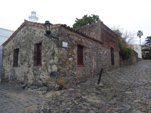
Friday night was spent in La Cruz, at a hotel a stones throw from the Rio Uruguay, which like most of the rivers in the area is in flood, though now receding. 


Brazil is across the river.

Another 300+ miles on Saturday and an overnight stay in Gualaguaychú, a short 25 miles from the border with Uruguay. The Rio Uruguay has to be crossed to reach Uruguay from Argentina. Some years ago an impressive bridge was built to connect the countries, though the day it opened it was occupied and blocked by environmental protestors from Argentina. The object of their fury, a paper mill the Uruguayans were building on the banks of the river, just upstream of the bridge. The protest and the blockade lasted 5 years. Long since gone, so my journey was uninterrupted. 

It is a toll bridge and motorcyclists have to pay, though a trivial amount compared to other vehicles. Once paid there are booths that house the immigration officials, an entry stamp to Uruguay doubles as the exit stamp from Argentina, the two countries have made an agreement for efficiency. Though the day I showed up the immigration officials were indoors (it was quite chilly outside). So I had to put the bike in reverse and duck walk it back to get to a parking spot. 

Once inside the passport was stamped, the temporary import permit to Argentina was turned in to their customs agent and the Uruguayan counterpart issued a new one for his country. Each agent stamps a pink square of paper, don't lose it because you drive up the road 400 yards and hand it into a guard (loose description) who waves you through. Welcome to Uruguay, 30 minutes in all. Take a look.


The eagle eyed will note that I took a turn off the main highway to Montevideo to visit Fray Bentos. Yes, Fray Bentos is a town, not just a brand of corned beef or steak and kidney pie in a tin. The brand name is not an accident, Fray Bentos was once home to the largest meat processing factory in the world and lent its name to some of the products the factory produced. It is also the place where the process of creating concentrated beef extract was invented, those products went by the brand name OXO. (It helps to be British, both household names for generations of Brits and still available today). 

The factory itself closed in 1979. From 1863 to 1960 it was under British ownership, from 1920 called the Anglo Company; in 1960 Anglo sold out as the fortunes of the Uruguayan beef industry were in decline (as Europe and other nations increased domestic production). It was sold (the factory, not the brand names) to the Uruguayan government in an effort to try and diminish the economic impact on the area. The site had 36 buildings, generated power for the plant and many of the local homes in Barrio Anglo (the first electricity supplied to a home in Uruguay was from the Fray Bentos factory) and employed 4,000 workers at its peak. However, the government finally threw in the towel in 1979, declared it a national heritage site and let it slowly rot. Fortunes changed in 2015 when UNESCO declared it a world heritage site for humanity (because of the impact on global nutrition at the dawning of the industrial age - for example OXO kept troops on both sides in WW1 nourished), a museum was created and certain parts of the factory can be viewed (asbestos insulation included free!). I took the tour (luckily the tour guide spoke English and was happy to use it) and spent two and a half hours fascinated by a place that until recently I had no idea existed and that was responsible for products I recall as a child.


The slaughter house, processing 1,500-1,600 head of cattle a day, 7 days a week. 


Scraps and rubbish meat, fat, and connective tissue were boiled with water, in multiple helical coil heated tanks, to extract the protein. The floating solids and fats were manually removed from the tanks and the liquid filtered to remove small particles. After filtration the liquid was sent into evaporators to be concentrated (OXO was originally sold as a concentrated liquid/gel, before a process was developed to remove all the water, creating a flat 'cake' that was cut and wrapped - say hello to OXO cubes!).


It took 32kg of beef material to create 1kg of the concentrated extract OXO liquid. That left a lot of cooked solid beef material to do something with. Have you ever eaten corned beef from a can? Hmmm, I really like(d) it. With the protein removed the nutritional value of corned beef is low, but it does provide bulk - which kept the WW1 soldiers feeling full when in the trenches, OXO liquid couldn't do that. Interesting huh!

A couple of other fascinating features were pointed out - the electricity generation control room and refrigeration plant had granite or marble floors, so did the faces to the electrical control panels. Expensive materials, but materials that do not conduct electricity (concrete does, it has water in it); it was used to save workers and more likely machinery from electric shocks in the event of accidents.


On the other hand the roadways outside were paved in iron plate. The plate was used as ballast by the ships that came up river to transport beef and finished products to the UK. The beef was the ballast on the return journey, the plate was not needed. It began to build up dockside, so it was repurposed as a road covering in areas of vehicle traffic, more durable than concrete but slippery when wet and not the place to stand during the frequent thunderstorms. So the workers were safe in the buildings but on their own outside!

This is the first domestic electric light bulb illuminated in Uruguay, courtesy of the Anglo Company. 


The last photograph shows two groves worn into a wooden floor. They were found under the desk of an Anglo office worker who spent 10-12 hours a day, 6 days a week at the same desk. He was a tall man at a small desk. Other than two 10 minute breaks a day, plus a short lunch, office workers had to remain at their desks. To exercise his long legs he shuffled them backwards and forwards, after 43 years it left its mark. Discovered after he retired.

Enough, but now you know the answer to the connection between Uruguay, Fray Bentos and OXO and a little more. Trivial Pursuits anyone?

All for now.

T2


Thursday, June 6, 2019

Argentina - Puerto Iguazu and the Falls

The central theme of this post is water. The journey to Puerto Iguazu commenced by crossing the international bridge over the Rio Parana from Paraguay to Argentina. Border formalities were completed quickly on exiting Paraguay. Things were slower on the Argentinian side, I joined the line of motorcycles waiting at the dedicated immigration booth for two-wheelers. 

There is a lot of commuter traffic into Argentina on a daily basis and chatting to the guy next to me in the motorcycle line it seems this is the daily routine, a 20-30 minute wait. With the immigration stamp in the passport it was on to customs. Obtaining the temporary vehicle import permit went smoothly and I was on my way.


The first planned stop was at the San Ignacio Mini Jesuit mission ruins, a UNESCO site on the Argentinian side. The 50 miles was punctuated by a variety of water views.


San Ignacio Mini mission ruins provided a richer experience than in Paraguay, with a museum and grounds that had a number of explanatory signs. It was interesting to see something of the local tribal culture, the Guarani, after which the Paraguayan currency is named. 


The stonework was more crude than at the Paraguay missions, which leads me to believe that San Ignacio was an earlier development. The stone carvings on the principle building (church, college, workshops) were no less ornate.


North of San Ignacio, and for the remaining 150 miles to Puerto Iguazu, the landscape was dominated by forest, hundreds if not thousands of square miles of it. The smell of fresh cut lumber hung in the air, the timber industry must be doing well.

Puerto Iguazu is a tourist town. The economy is driven by visitors coming to look at the falls within the Iguazu National Park and that is what brought me here.

My hostel is in a quiet residential area so I was surprised to find a very nice restaurant just 200 yards away. Del Fonte served excellent and innovative food in a well appointed restaurant, the service was impeccable; this was NYC quality for less than $25 for three courses and wine. I wish I had my camera to record my main course, lasagna shaped like a flower - it looked great and tasted better.

So to Iguazu Falls, another UNESCO site. The images in the video do the talking. The park is full of wildlife and the variety of butterflies was astonishing, I managed to capture a couple of shots of them. 
After visiting the falls I walked the short distance from my hostel to the Hito Tres Fronteras, to view the point in the river where Paraguay, Brazil and Argentina meet. The point is just a little above where the ferry is in the picture below.


Thursday I point my wheels south, the 2 day journey to arrive in Uruguay begins.

T2.

Tuesday, June 4, 2019

Asunción and the Misiones Region, Paraguay

Asunción has three distinct areas, the old city where the government offices are, the old Mercado area and the new commercial center, The Premier Hill hotel is near the old center which is where I sent my time. If all of the old buildings had received the same attention as the one below it would be a stunning city. Sadly there is more decay than renewal.


There is a nice promenade along Asunción Bay of the Paraguay River, which the Presidential Palace overlooks.


And where the often photographed city name is located.


The river is at least 6 or 7 feet above the normal level, flooding across the bay is clear to see. What I thought was an old passenger ferry tied to the bank is actually operational, life preservers were locked up in the well of the vessel. The view across the bay is pleasant.


I enjoyed my stay and glad I visited, though it did not rank as my favorite capital city. Only a very small part of the historic area has any life to it. Strangely, Sunday lunchtime there were more restaurants open than on Saturday which gave the center a bit more character.

Monday I headed out of Asunción to the southeast and into the Misiones Region. 40 minutes and 8 miles gave me an appreciation for just how big a city Asunción is, in addition to exhibiting a different part of the city, that looked a lot better kept than the old center.

RN1 is a delight to ride on a sunny day, passing through rolling hills with well maintained farms. I had read that Paraguay is one of the poorer nations in South America, but that is not the impression gained as I passed through a number of small towns. The roads were paved, properties well kept, zero litter and an ambience of calm and quiet confidence, not an experience I had when travelling through small towns in countries further north.

Encarnacion is at the end of RN1 and sits on the west bank of the Rio Paraná; on the east bank the much larger city of Posadas, Argentina. The two cities are connected by an impressive bridge that serves as an international border crossing. The river is very wide at this point, perhaps as a result of a hydroelectric project downstream. In any event the river is navigable.

The area has several ruins of the Jesuit Missions dating from of the late 1600's through to the mid 1700's. I visited two, in Trinidad and the nearby and older site at Jesus. The buildings fell into ruin after the Spanish Crown expelled the Jesuits in 1767 and beyond. The Jesuits had a compassionate stance towards the local tribes and they became too powerful for the liking of the Spanish court. It probably didn't end well for the native population. Both sites are on the UNESCO world heritage lists.

While visiting the site at Jesus three fledgling burrowing owls had emerged from their nest, one hung around long enough to get a couple of decent pictures. 


Wednesday I return to Argentina.

T2

Monday, June 3, 2019

Salta, The Chaco and into Paraguay

Adding to the last post, the journey to Salta from Jujuy follows Ruta Nacional 9 a narrow road that winds its way through the hills and valleys south of Jujuy, an area that was clearly a summer retreat from the heat, humidity and mosquitoes of the flat lands, the Chaco. My expectations of Salta were raised by the write up in Lonely Planet, though it disappointed. Outside of the main square the streets were littered and the local dogs made walking on the pavements unpleasant. The place needed some TLC.

The 700 mile crossing of the Chaco commenced with a 40 mile unpaved road out of Salta following the path of a local military man of the early 1800's, who was fighting in a civil war. He met his death as he tried to escape through the hills, shot in the back on what is now Ruta Provincial 48. It got a little gnarly in places for me too.

The Chaco is a flat land, swampy in places, crossed by RN16, an almost arrow straight road for 500 miles. Like the US Midwest the area is given over to agriculture, arable (cotton and corn seemed to be the most common crops) and raising cattle. Small towns punctuate the route every 30 miles or so with a larger settlement every 100-150.

The journey on RN16 was broken up with an overnight stay in Pampa de Guanacos before moving on to Formosa. Both days were dreary with periods of drizzle and rain. No doubt it looks better in the sun, but not by much.

To reach Paraguay from RN16 it is necessary to head north on RN11. Still flat, more swampy and with only cattle in evidence and an increasing number of palm trees it had the feel of the Florida Everglades. Flooding from the April rains was still apparent.

Formosa is a 100 miles up RN11 and sits on the Paraguay River, currently near flood stage after the devastating rains in the Chaco. I had no expectations of the place, simply an overnight stop before heading to Paraguay. Where Salta disappointed Formosa delighted. Clean with a wide main avenue and a central walking area, a very large main square, pedestrian shopping areas and numerous cafes and restaurants.


The mud covered roads of the Chaco, coupled with the wet conditions, had  left the bike filthy. A local auto lavenderia was willing to make an exception and power wash the bike. Godfredo, the owner, turned out to be a biker and gave me good information about the area. He refused payment, saying he was happy to help a fellow biker who was riding his dream. Nice!

It is 80 miles from Formosa to arrive at the Paraguay border. Normally two options exist to enter Paraguay  a land crossing or a ferry across the Paraguay River. The ferry was not operating due to the flooding, so the land crossing it was to be.

The road north passed through more Everglade looking scenery, and the local penitentiary, before reaching the crossing point. The border was chaotic, cars, people and a line of trucks parked up. Surprisingly, out of the chaos came order, all the formalities were completed in 40 minutes. 

The first mile of road in Paraguay did not set the tone for the 20 mile ride to Asuncion. The line of trucks to cross into Argentina was even longer. 


Cheers T2